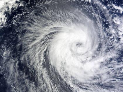
Cyclone Dana Update: Cyclonic Circulation Over Andaman Sea Likely To Intensify Into Low-Pressure Area, Says IMD
By Lokmat English Desk | Updated: October 20, 2024 10:14 IST2024-10-20T10:13:47+5:302024-10-20T10:14:37+5:30
The India Meteorological Department (IMD) has announced that a cyclonic circulation has formed over the Andaman Sea, and it ...

Cyclone Dana Update: Cyclonic Circulation Over Andaman Sea Likely To Intensify Into Low-Pressure Area, Says IMD
The India Meteorological Department (IMD) has announced that a cyclonic circulation has formed over the Andaman Sea, and it is expected to intensify into a low-pressure area by Monday. This development could impact the coastal areas of northern Andhra Pradesh, Odisha, West Bengal, and Bangladesh in the coming week.
In a bulletin, the IMD stated, "A cyclonic circulation has formed over the central Andaman Sea. Under its influence, a low-pressure area is likely to form over the Bay of Bengal and adjoining northern Andaman Sea around October 21. It is expected to move northwestwards and further intensify into a depression by October 23."
This system in the Bay of Bengal may develop into a cyclonic storm named 'Dana.' The Meteorological Department has warned of heavy rainfall in Odisha, Tamil Nadu, and Gujarat on Sunday, October 20. Additionally, the department has indicated signs of a cyclonic model forming in the Bay of Bengal over the coming days.
Weather Update by Director General on Possibility of Formation of Depression Over Bay of Bengal
बंगाल की खाड़ी पर अवदाब (Depression) बनने की संभावना पर महानिदेशक द्वारा मौसम अपडेट#IMDWeatherUpdate#imd#bayofbengal#weather#weatherforecast#weatherupdate@moesgoi@ndmaindia@airnewsalerts@DDNewslive@DrJitendraSinghpic.twitter.com/oj7xXofx0X
— India Meteorological Department (@Indiametdept) October 19, 2024
Weather experts note that October is commonly referred to as the "Month of Cyclones." IMD Director General Mrityunjay Mohapatra addressed the ongoing weather activity in the Bay of Bengal on Saturday. He mentioned that a low-pressure system could form in the Bay of Bengal on Monday, October 21, exhibiting characteristics of a multi-cyclonic model.
Peninsular India is currently experiencing continuous rainfall. Rainfall persists over parts of Odisha, coastal Andhra Pradesh, Tamil Nadu, interior and coastal Karnataka, Konkan, Goa, Maharashtra, and Gujarat, and it may intensify over the next two to four days.
Tamil Nadu and Odisha recorded the highest rainfall of 170 mm on Saturday, according to the Meteorological Department. A rain alert has been issued for Sunday, with heavy rainfall expected over parts of Odisha, Andhra Pradesh, Telangana, interior Karnataka, Maharashtra, Goa, Konkan, and Gujarat. The IMD has issued a yellow alert for these states, while an orange alert has been declared for Tamil Nadu due to the likelihood of very heavy rainfall.
The IMD has also mentioned that cyclonic activity is occurring in the central Bay of Bengal, which could bring heavy rainfall to areas from coastal Tamil Nadu to Andhra Pradesh. The department predicts the formation of another low-pressure system in the Bay of Bengal around October 21, which may cause heavy to very heavy rainfall across Peninsular India between October 24 and 25.
Open in app